


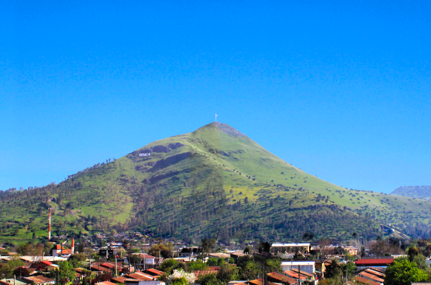
ESTABILIDAD CERRO RENCA (CHILE)
Estudio geotécnico asociado al diagnóstico de terreno de deslizamiento en Cerro Renca, el cual incluyó monitoreo periódico por 1 año de deformaciones (topográfico, inclinométrico, InSAR) y estudios geofísicos, geológicos y geotécnicos.
contacto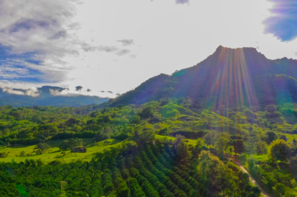
MINERA QUEBRADONA (COLOMBIA)
Caracterización geotécnica, geológica, geofísica e hidrogeológica a nivel de factibilidad de la mina Quebradona, aplicado a diseño de depósito de relaves filtrados.
contacto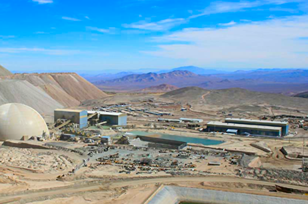
COMPAÑÍA MINERA ZALDÍVAR (CHILE)
Ingeniería de Factibilidad - Influencia de la Explotación Fase 15 sobre infraestructura del Chancador Primario. Estudio incluyó Caracterización Geotécnica, Geológica y Geofísica, Análisis de Estabilidad y Deformaciones (FLAC 3D) y Análisis Estructural de Chancador.
contacto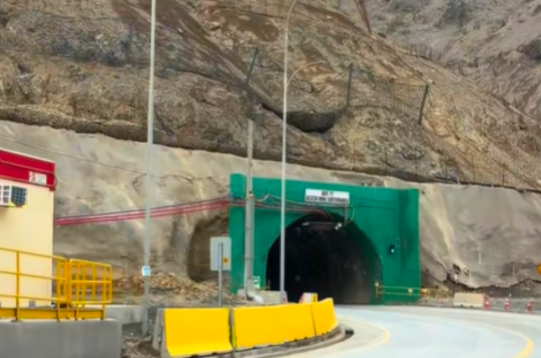
ESTUDIO DE AVALANCHAS Y DISEÑO DE MEDIDAS DE MITIGACIÓN, ADIT 77, EL TENIENTE CODELCO (CHILE)
Estudio de anteproyecto e ingeniería de detalles de medidas de mitigación frente a eventos de caída de rocas, avalanchas y flujo de detritos en Adit 77, El Teniente, Codelco.
contacto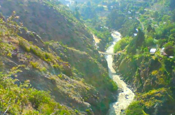
CUENCAS DE LO BARNECHEA (CHILE)
Estudio de caracterización geológica de las cuencas de Ñilhue y Huallalolen. Análisis de riesgo geológico, evaluación del comportamiento de deslizamientos, soluciones de ingeniería y elaboración de un plan de emergencia
contacto
ILUSTRE MUNICIPALIDAD DE LO BARNECHEA (CHILE)
Diseño de Arquitectura e Ingeniería de 2 pasarelas, incorporando estudios de mecánica de suelos y estudios geofísicos, caracterización geotécnica, estudios hidrogeológicos e hidráulicos, junto con el desarrollo de los correspondientes diseños civiles, memorias de cálculo y planos técnicos.
contacto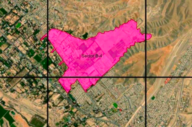
SERVIU ATACAMA (CHILE)
Diseño del sistema de mitigación de aguas lluvias y drenaje urbano en el Sector B-4, incorporando estudios de mecánica de suelos, estudios geofísicos, caracterización geotécnica, estudios hidrogeológicos e hidráulicos, junto con el desarrollo de los correspondientes diseños civiles, memorias de cálculo y planos técnicos.
contacto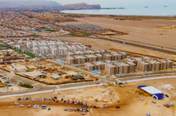
SERVIU REGIÓN DE ARICA Y PARINACOTA (CHILE)
Mejoramiento Vías Urbanas, Sector Borde Pampa, Arica, El proyecto desarrolla la ingeniería de las alternativas que buscan mejorar la conexión de la movilidad local con vías urbanas principales. Considera estudios de caracterización geotécnica, hidrogeología, topografía, y desarrollo de diseños civiles.
contacto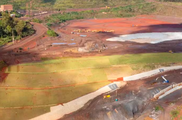
DEPÓSITOS MONJOLO Y VALE DAS COBRAS – BRASIL:
Análisis crítico de dos depósitos de relaves (Monjolo y Vale das Cobras, Minera Vale, Brasil). Caracterización geotécnica e hidrogeológica, análisis de estabilidad, y estudio de optimización de cierre minero (depósitos de relaves filtrados).
contacto
MINERA QUEBRADONA – COLOMBIA:
Caracterización geotécnica, geológica, geofísica e hidrogeológica a nivel de factibilidad de la mina Quebradona, aplicado a diseño de depósito de relaves filtrados.
contacto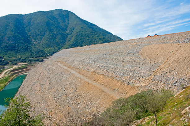
NUEVOS DEPÓSITOS DE RELAVES (CODELCO- EL TENIENTE) – CHILE:
Estudio de nuevos depósitos para ser aplicados desde el año 2035 y que consideró disciplinas de geotecnia, geología, hidrogeología principalmente.
contacto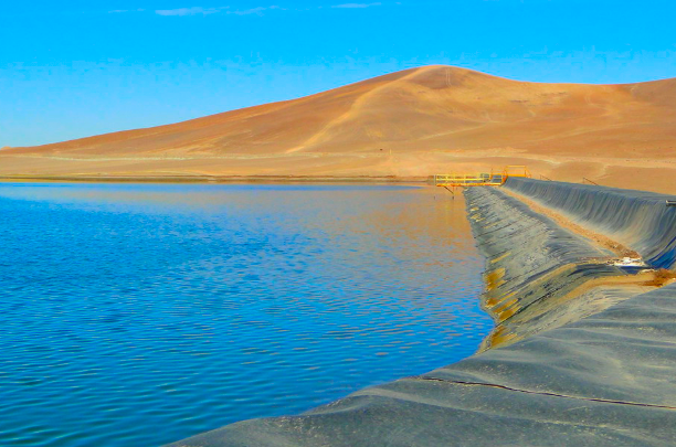
DEPÓSITO DE RELAVES PAMPA AUSTRAL (CODELCO-SALVADOR) – CHILE:
Análisis de estabilidad para etapa final de los Nuevos Muros Sur 1 y Sur 2. Proyecto Rajo Inca, DRPA. Consultoría Experta de Contraparte. Ingeniería de Factibilidad peraltamiento DRPA Etapa 2.
contacto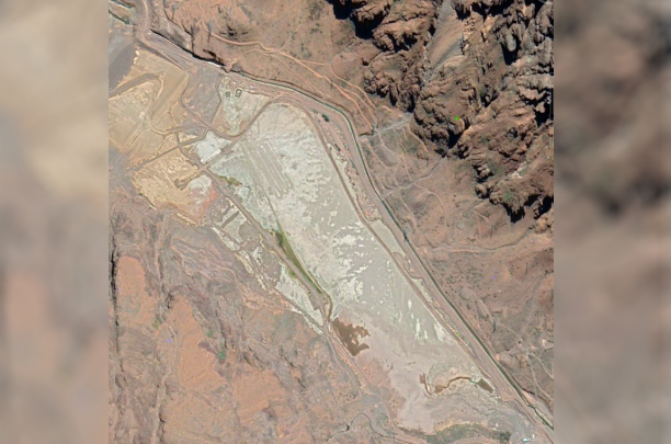
TRANQUE PIUQUENES (CODELCO-ANDINA) – CHILE:
Estudios Geotécnicos asociados a Impacto del sellado del Ducto Piuquenes en estabilidad de depósito.
contacto
TRANQUE TALABRE (CODELCO-CHIQUICAMATA) – CHILE:
Caracterización geotécnica y diseño de fundaciones. Proyecto de línea de media tensión en el área del depósito de relaves Talabre.
contacto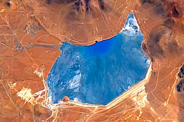
PAMPA PABELLÓN (CMDIC):
Estudios Geotécnicos, Ingeniería de Detalle By Pass Canal de Contorno Oeste, continuidad operacional del depósito de relaves Pampa Pabellón.
contacto
MINERA INDE (MINA LA CRUZ) – MÉXICO:
Estudio geotécnico del botadero existente y del nuevo botadero proyectado. Diseño conceptual geométrico, análisis de estabilidad 2D en perfiles críticos, y especificaciones técnicas para crecimiento por etapas, con planos en planta y secciones representativas (2024).
contacto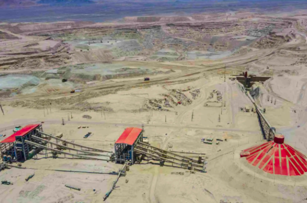
DGM (CODELCO) - CHILE:
Proyecto Ampliación Fase IX Botadero de Ripios, Estudios Geofísicos (Refracción Sísmica, MASW y Nakamura) para Ingeniería de Factibilidad (2022).
contacto
SPENCE (BHP) - CHILE:
Participación en panel de expertos (GRB) Pampa Norte. Proyectos Spence Ripios Dump Capacity (SRDC), Spence Ripios Reprocessing (SRR) and Spence Chalcopyrite (SCPY). 2024.
contacto
LOS BRONCES (ANGLO AMERICAN) - CHILE:
Estudios geotécnicos y análisis de estabilidad de botaderos de desmonte y pilas de lixiviación. (2021).
contacto
DGM (CODELCO) - CHILE:
Proyecto Ampliación Fase IX Botadero De Ripios. Estudio de Mecánica de Suelos, Ensayos de Laboratorio y Caracterización Geotécnica (2022)
contacto
LOMAS BAYAS (GLENCORE) - CHILE:
Análisis De Estabilidad y Flujo Pilas de Lixiviación (2021)
contacto
TRANQUE TALABRE (CODELCO) – CHILE:
Caracterización geotécnica de botadero de roca estéril para su uso como material de enrocado. Desarrollo de plan de explotación, selección, compactación y control de materiales para rellenos de depósito de relaves.
contacto