Satellite images are a great help to solve different geological problems, they are a key tool in multiple fields such as geotechnics, hydrogeology, regional geology, structural analysis, mining exploration, geomorphology, geological mapping, etc. These images, through photo interpretive analysis, allow large areas to be studied in a short time and at a lower cost in the exploration stages, they are also key in areas of difficult access in which it would otherwise be almost impossible to obtain information.
Satellite images are the visual representation of information captured by a sensor mounted on an artificial satellite. Some of the most used images in geological exploration today are: LANDSAT, ASTER, ALI, QUICKBIRD, SPOT, HYPERION.
Landsat satellites are intended for the study of natural resources, for years several of these have been launched into space with the aim of collecting multiple images of the earth, they systematically and repetitively cover the surface of the earth by rotating around it, to later send this information to the earth where it is processed. The analysis of landsat images basically consists of a photo interpretation in which these images can be modified by means of techniques that allow certain features or elements to be enhanced.
Multispectral analysis and techniques to highlight certain elements of the image, such as color compositions, digital analysis, etc., complement geological research, providing great advances in geological study. Satellite images are also used in the elaboration of geomorphological maps, updating of geological charts, as well as helping in the conservation of the environment by providing data on the changes that occur due to climate change.
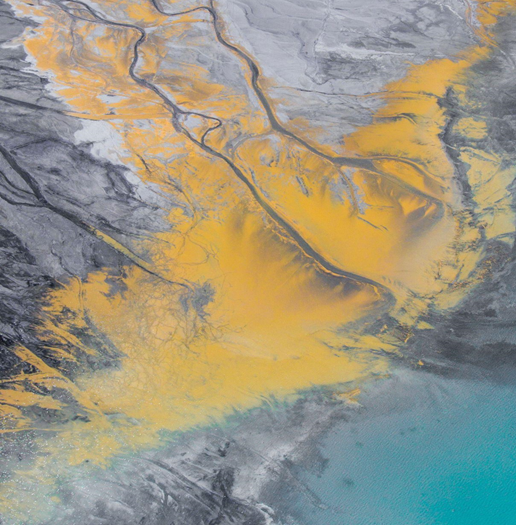
Satellite images from Remote Sensing are very useful in geological and mining mapping since the different wavelengths deliver a large number of data needed in these areas. The multispectral and hyperspectral sensors allow the identification of different types of lithology, the recognition of minerals such as alunite, illite, chlorite, kaolinite, epidote, oxides, etc. Satellite images have been applied with great success in structural geology, since they allow the identification of large linear features. The bands most used for mapping minerals are those corresponding to the visible and infrared spectrum.
Some applications of satellite geological mapping and remote sensing are:
- Determination of hydrothermal alteration zones.
- Determination of mineralized zones (mining).
- Hydrogeology.
- Hydrology.
- Geological risk studies,
- Environmental impact studies.
- Iceberg motion control.
- Geological cartography.
- Mapping of coastal waters, forestry and urban.
- Discrimination of type of rocks and soils.