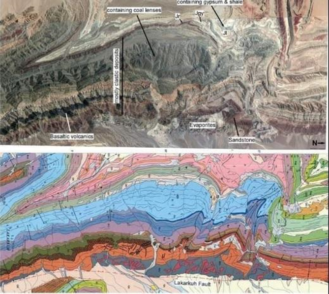
Geological mapping corresponds to the way in which geologists capture the physical characteristics of nature in an understandable format, using paper or any digital medium. In other words, it is the cartographic representation of all the observable geological features at a site.
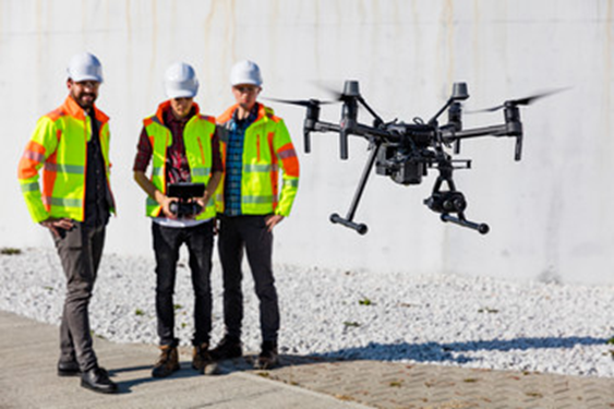
Drones, which are unmanned aerial vehicles capable of autonomously maintaining a controlled and sustained flight level, are used for geological mapping. These provide control of extended areas, monitoring of planned routes, as well as contributing to security and surveillance.
Geotechnical mapping corresponds to the recording of geological-geotechnical parameters which are obtained in field work. These data allow characterizing and classifying the rock mass, thus evaluating the feasibility and execution of a project.
These mappings are performed through geomechanical classifications, which are based on standards such as ASTM (American Society for Testing Materials) and ISRM (International Society for Rock Mechanics).
Our services correspond to:
- Review of information.
- Field reconnaissance.
- Laboratory tests:
- Uniaxial compression test.
- Triaxial compression test.
- Point load test.
- Tilt test.
- Preliminary in situ investigations (preliminary project).
- In situ investigations (project).